 Matlab scripts by Robert Thombley, SIO-CalCOFI with Sep2014 error correction by Augusto Valencia, UABC; based on Weber & Moor 2013.
Link to MatLab downloadable code authored by Robert Thombley, SIO-CalCOFI
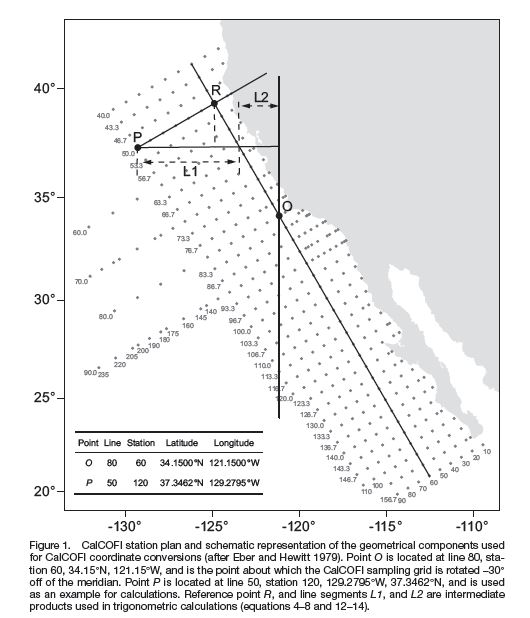
(Abstract from pdf) "Converting between geographic coordinates in latitude and longitude and the line and station sampling pattern of the California Cooperative Fisheries Investigations (CalCOFI) program is a commonly required task for conducting research on the California Current ecosystem. This note presents several corrections and clarifications to the previously published algorithms for performing these conversions. We include computer code to implement the algorithms in Java™1, Perl, Python, and R. We note that freely available code to conduct the conversions in Fortran, Matlab®2, JavaScript™, and Visual Basic®6 has previously been published, and an online conversion tool is also available. A future version of the PROJ.4 cartographic projections library will also include support for CalCOFI conversions, thereby allowing for convenient conversions using the GRASS GIS, PostGIS, Python, Perl, R, and many other programs and programming languages."
For individual language - Java, Perl, Python, or R - implementations & downloads, see the algorithms page
