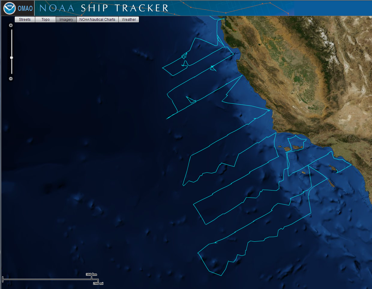
CalCOFI-DEPM 1304SH, 6 - 30 Apr 2013 on NOAA RV Bell M Shimada, completed 111 stations: 80 CTD hydrographic stations, 31 Pairovet & Trawling Stations.
Preliminary plots of 10m & 100m measurements | Preliminary CTD data files
| CalCOFI 1304SH Cruise Track for Legs 1 & 2 - weather dictated the station order so coastal stations were occupied during the first part of the cruise while winds were 40+kts offshore. Leg 2 northern lines were primarily CUFES transits, pairovets & trawling stations at night, CTD stations during the day. | The sardine egg distributions (SWFSC Egg Map Direct Link posted by Ed Weber) so far indicate the majority of the spawning biomass off the central California coast, with small, highly dense spawning "pulses" in the SCB. |
 |
 |
| Click images for larger version. | |
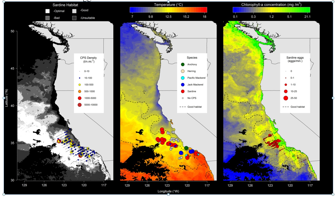
| The most recent habitat map prepared by Juan Zwolinski is shown below. Note that the egg data may be a little out of date. | |
 |
|