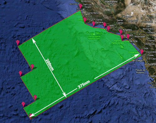
CalCOFI's sampling area has evolved over the 65 years of the program. The 66 standard station pattern in the Southern California Bight (SCB) has the best coverage since 1949. The current 75 station pattern, 66 standard + 9 SCCOOS 20m stations, was implemented in 2004. Refer to the Station Positions web page for coordinates for individual CalCOFI stations. Using perimeter station positions and several coastal station reference positions, here is the estimated sampling surface area using Google Maps Area Calculator:
|
CalCOFI Sampling Area 189789822071.78 m² 189789.82 km² 46898086.52 acres 2042880648994.29 feet² 55263.19 square nautical miles |
Download working area KML File Here (refer to the map for points, download the KML for the actual positions used). Please note that island area has not been excluded. See the 113 Station Positions KML on Google Maps |
 |
|